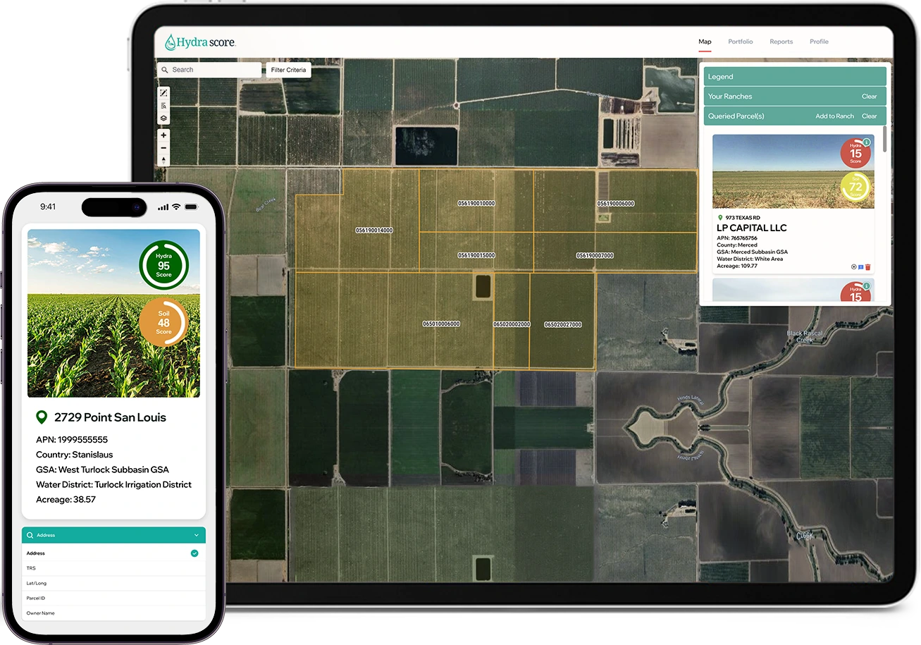
Precision Data and Analytics for Investment Success
Advanced analytics for assessing water rights and soil quality, empowering financial decisions with precision and foresight.
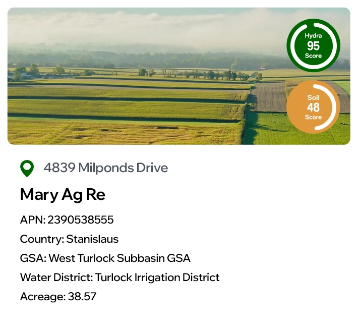
Understand Water Availability
with Hydra Score
Hydra Score equips clients with a detailed overview of water rights and current water availability by analyzing existing data and regulatory frameworks.
This allows for a thorough understanding of the present water landscape, enabling informed decisions on land use and investment.

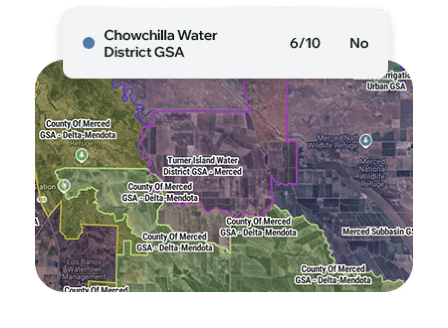
Groundwater Sustainability Agency (GSA) Ratings
Understand GSA ratings based on: priority ranking, GSP acceptance and implementation status.
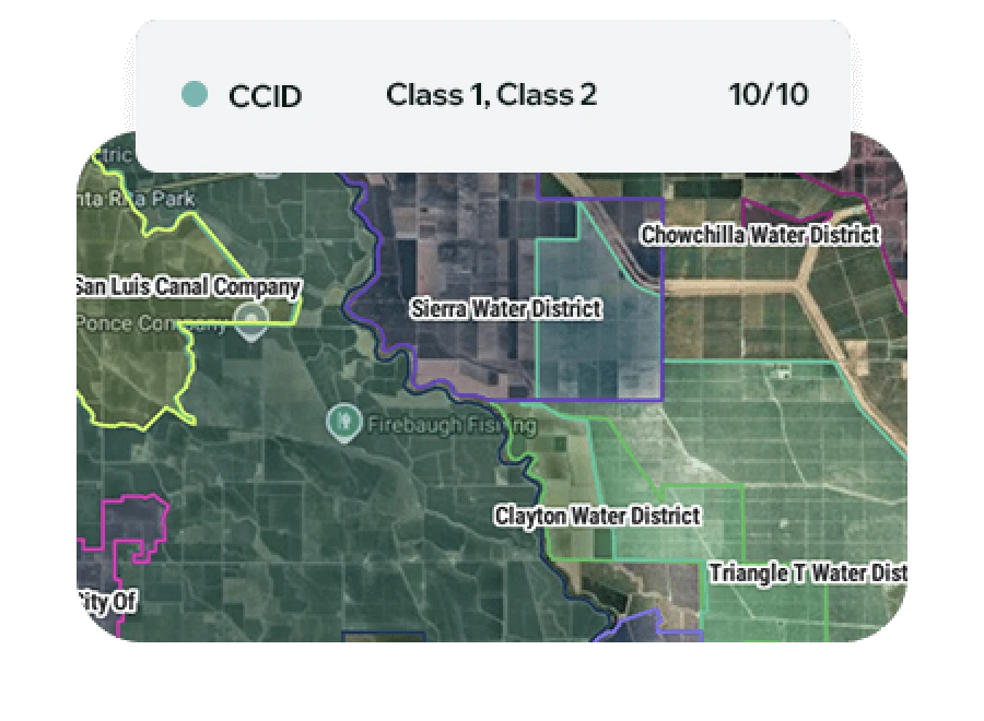
Water District
Ratings
Understand Water District strength based on water rights, allocation efficiency, and compliance with current water regulations.
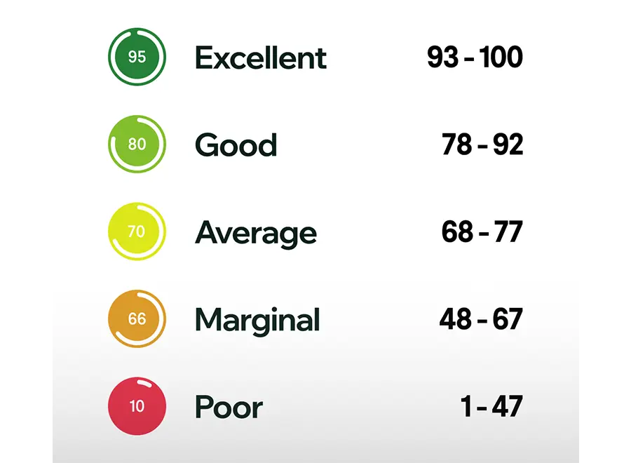
5-Tiered Rating
System
Quickly understand the overall water supply for a given parcel, ranch, or collateral group with easy to
grasp ratings.
Evaluate Your Ground
with Soil Score
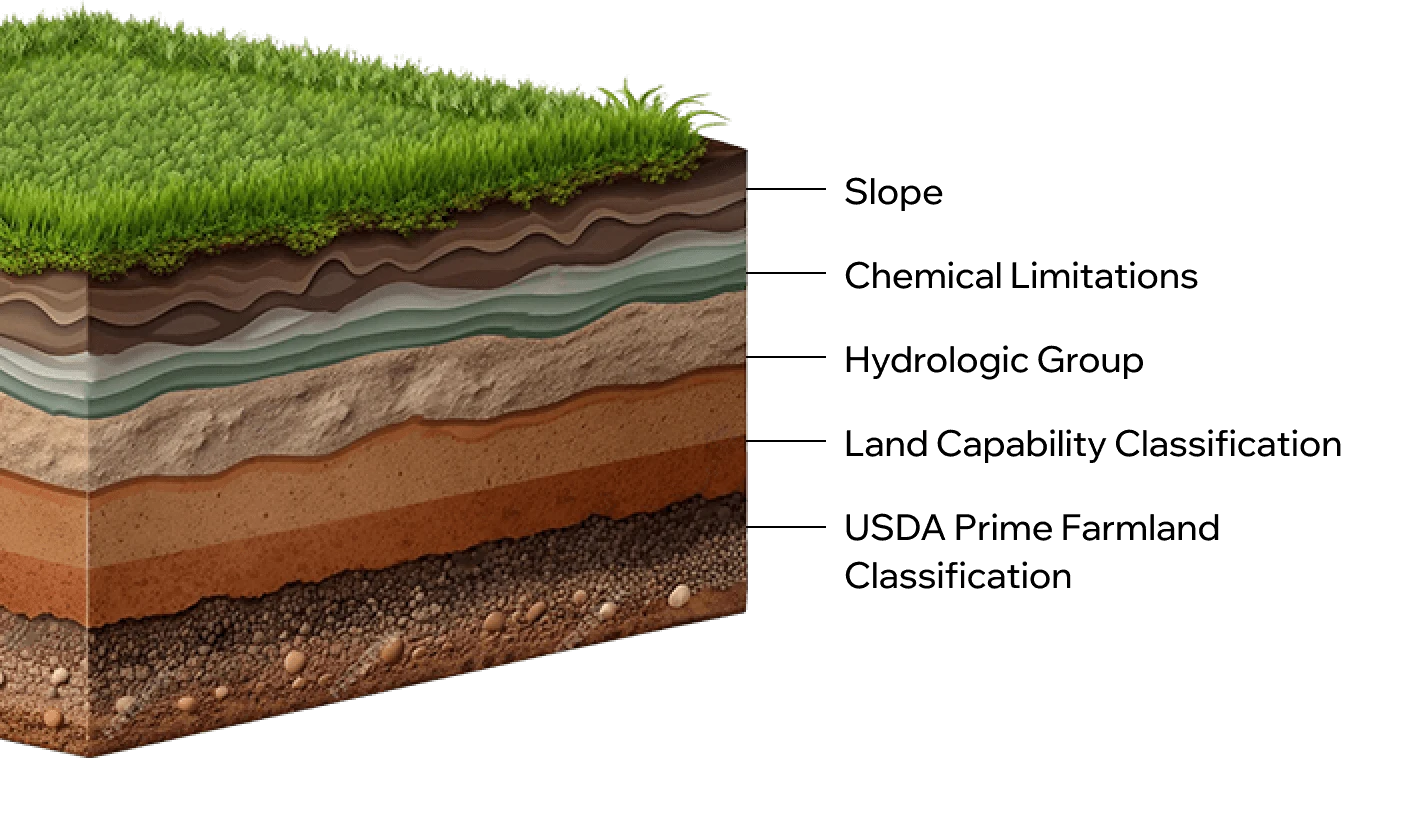
Soil Score assesses soil quality by integrating five key classifications into a weighted average score, reflecting the soil’s overall versatility and fertility.
Soil Score helps clients understand the agricultural potential and suitability for various land uses, guiding investment and management decisions.

Soil Score Factors
Efficiently evaluate ground with a composite measurement of five soil quality indicators.
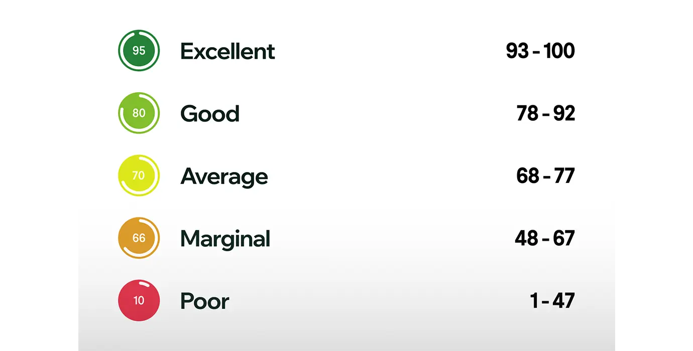
Score Buckets
Compare ground from site to site with our five-tiered rating scale.
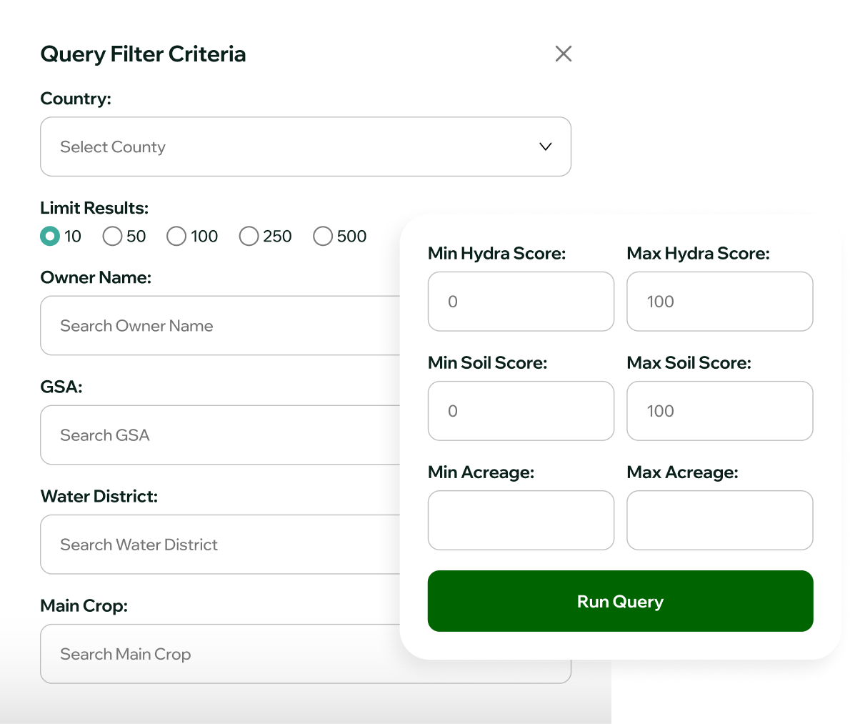
Search by criteria
Farmers find your perfect plot with a targeted search based on your criteria. Lenders easily find parcels across the state by owner name or mailing address.
Try It FreeReports
Consolidate relevant water, land, and property data points into a single, comprehensive report simplifying the analysis process for a single parcel or a group of parcels.
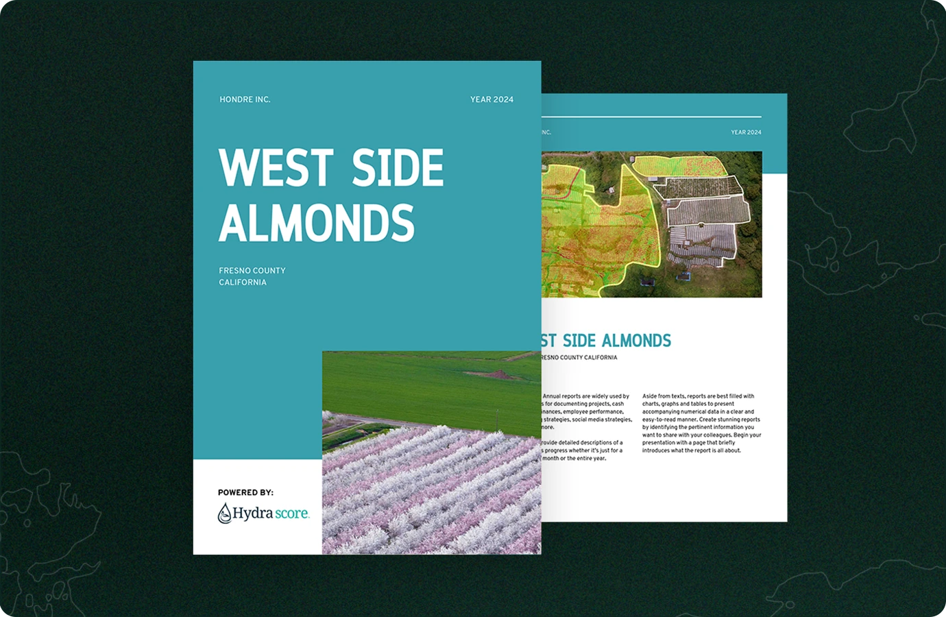
Key Insights
From legal boundaries to water rights to soil quality,
explore and evaluate all aspects of your investment risk.
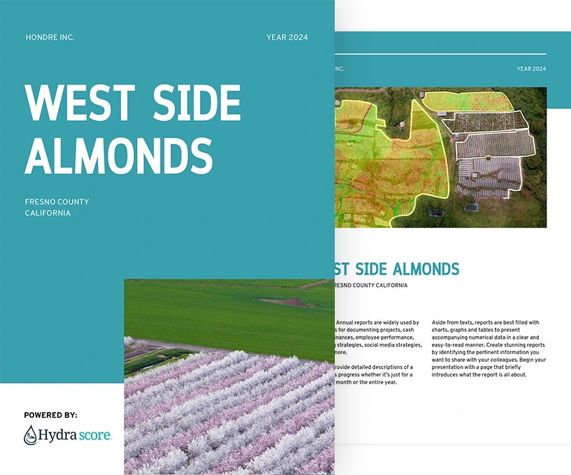
Data Layers
All relevant agricultural data layers in one place to save time and further inform your decisions.
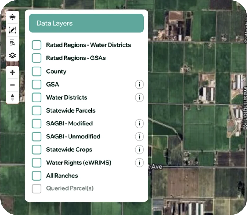
Flood Risk Maps
Visualize flood risk to your property to simplify long term
decision making.
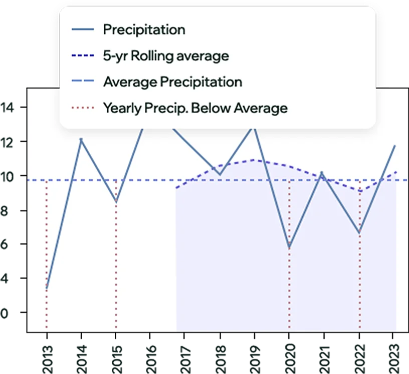
Climate Data
Easily access regional weather data to ensure you select the right property to fit your crop's
weather requirements.
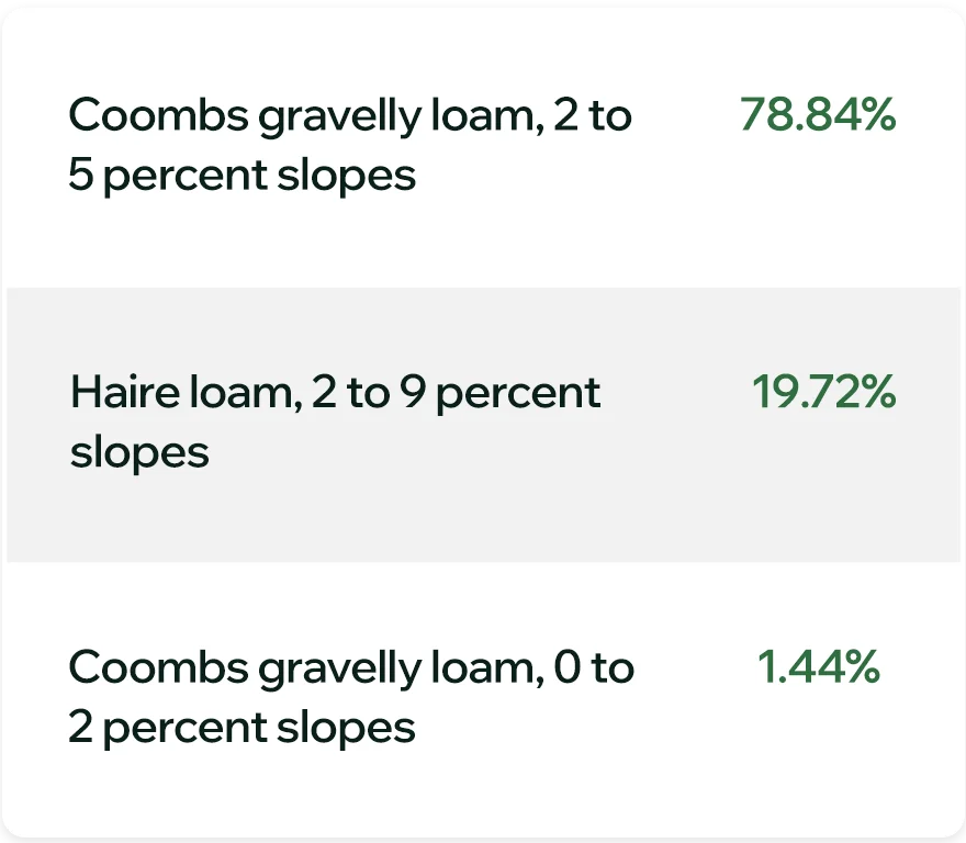
Soil Types
Get ahead of potential drainage and tillage issues with detailed
soil composition.
Soil Properties
Utilize detailed soil analysis to assess crop productivity potential and chemical requirements.

Property Ownership
Fragmented property ownership data all in one place.
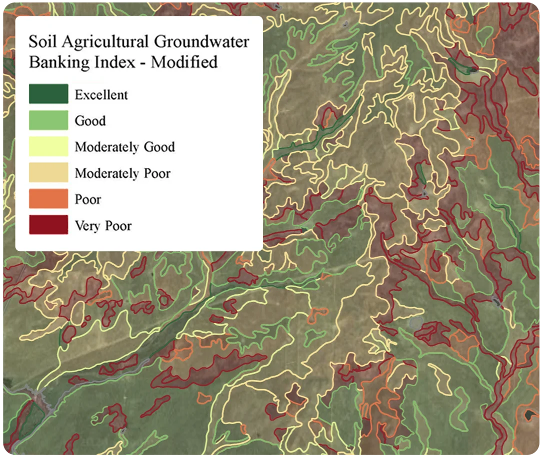
Groundwater Banking
Assess groundwater banking suitability with modified and unmodified SAGBI layers.
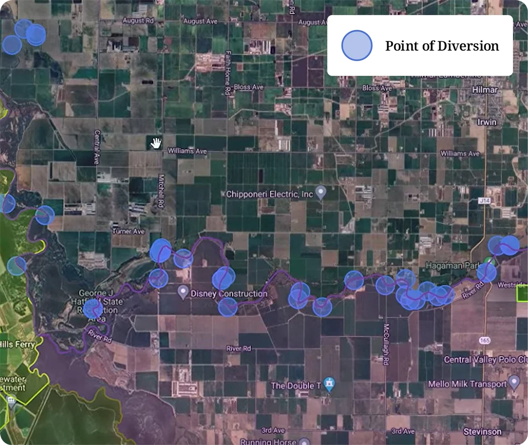
Water Rights
Quickly locate and visualize points of diversion on the map. Easily find application ID’s to query eWRIMS database.
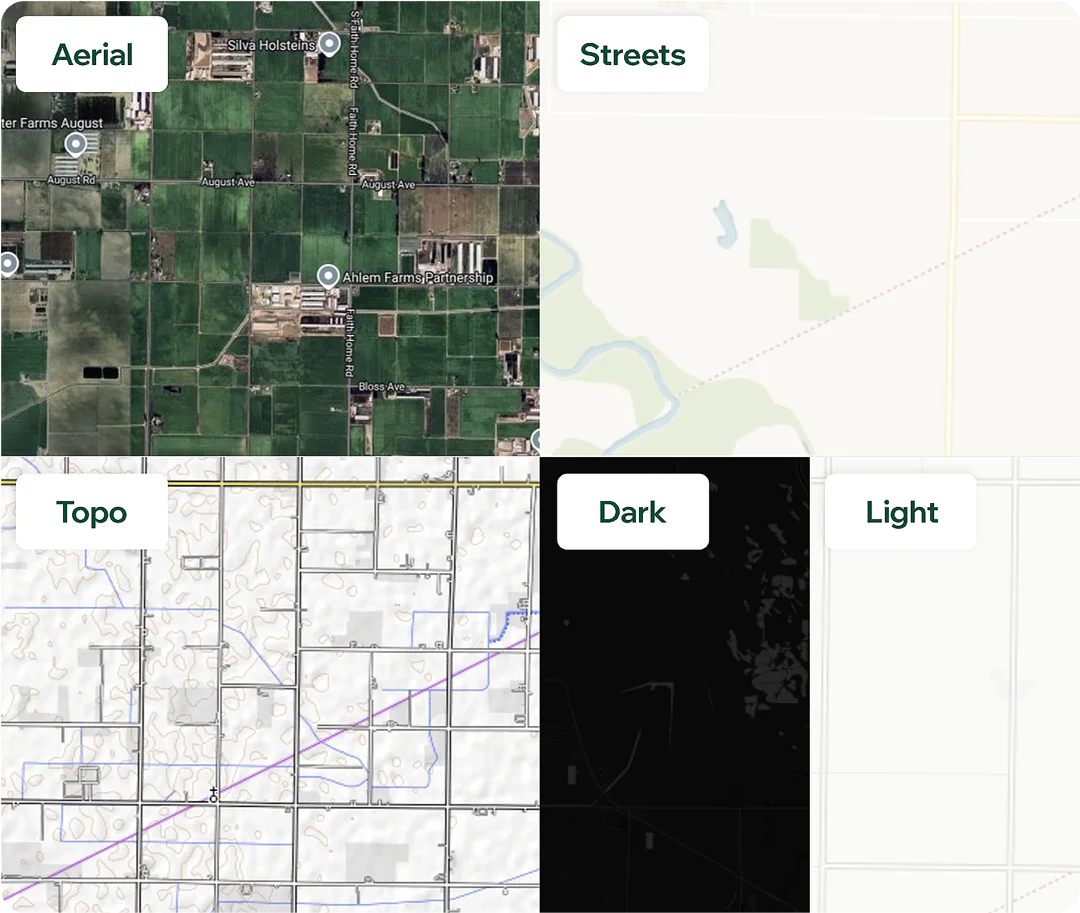
Base Maps
Your maps, your way. There's a base map for every use-case.